Boat AIS: installation, commissioning and limits
From transponder choice to checking transmitted data, this practical guide explains how to plan, commission and use onboard AIS without mistaking it for radar.
In brief
A useful AIS transponder must do more than power up: it needs the correct MMSI, accurate static data, a reliable GNSS position, a sound VHF antenna installation and a readable display at the helm. Commissioning must confirm both reception and transmission. Even then, AIS is supplementary: it cannot show every vessel and never replaces lookout, radar or the COLREGs.
Article outline
AIS can remove anonymity from a busy horizon, but only when identity, sensors, radio, antennas and display work as one chain. A target list on a chartplotter proves neither that the boat is transmitting correctly nor that every real vessel appears on the screen.
This guide concerns a fixed transceiver on a recreational boat. A receive-only set cannot make the boat visible, while AIS-MOB and AIS-SART locating devices serve a different emergency purpose. Carriage and licensing rules vary by flag, vessel and operating area, so the applicable national authority and the equipment approval valid in that market must be checked before purchase.
Define the job before choosing the class
A transponder receives other stations and broadcasts its own identity and movement data. Class A is built around the functions and carriage standards applying to specified SOLAS ships; voluntary leisure installations commonly consider Class B. That distinction is more important than a long accessory list because it determines how the station accesses the radio channel and what information it sends.
Class B comes in carrier-sense TDMA and self-organising TDMA forms, usually labelled B/CS and B/SO. US Coast Guard guidance says both interoperate with other AIS stations, while Class B reports position less often and at lower power than Class A. The same guidance characterises B/SO as generally more capable and B/CS as generally less expensive.
Speed changes the comparison. IMO Resolution A.1106(29) gives B/SO nominal reports every 30 seconds between 2 and 14 knots, 15 seconds between 14 and 23 knots and 5 seconds above 23 knots; its B/CS table gives 30 seconds whenever the craft is moving faster than 2 knots. Those figures support a design decision, not a marketing verdict. Batoo’s analysis is that B/SO deserves particular consideration for faster craft and regular operation in dense traffic, but installation quality and a readable display can matter more than class on a slow coastal boat.
Treat MMSI programming as identity work
An MMSI is an officially assigned nine-digit maritime identity, not a serial number or a placeholder to invent during setup. The issuing and amendment process belongs to the relevant administration. In the United States, for example, the Coast Guard says US-sold Class B units are not user configurable under FCC rules; owners needing changes should follow the installer, maker or retailer route stated in the official guidance.
Prepare the data before anyone opens the programming screen. The commissioning sheet should carry the exact vessel name, MMSI, call sign where assigned, vessel type, and the dimensions referenced to the GNSS antenna position. Using an old name after a sale or putting bow and stern offsets in the wrong boxes exports the error to every nearby bridge.
Consistency across onboard radios matters as well. Where VHF DSC and AIS represent the same vessel, their identities should not conflict. The IMO warns that received information is only as accurate as the information transmitted and that badly configured or calibrated position, speed or heading sensors can create dangerously misleading data. Keep a dated configuration record so that replacement hardware is not programmed from memory.
Design the radio, GNSS and power paths
The VHF installation is a safety-critical signal path. AIS primarily uses two dedicated VHF channels, while its dynamic position relies on GNSS. The unit, feedline, connectors, circuit protection and antenna arrangement therefore need to follow the specific manufacturer’s instructions and the rules applying to the vessel; there is no honest universal cable length or antenna spacing number for every installation.
A dedicated AIS antenna separates failures in the transponder path from the voice-radio antenna, at the cost of finding a suitable mounting position and separation. A compatible active splitter can share an antenna and save space, but it adds hardware whose failure behaviour and power state must be understood. A passive television-style splitter is not a substitute. If the transponder’s internal GNSS receiver lacks a sound view of the sky, the approved external GNSS antenna option may be necessary.
Power should remain within the maker’s limits during engine cranking, charging and battery changeover. Size the conductors and protection from the actual run and load rather than copying another boat. On the data side, confirm that the chartplotter or multifunction display can decode the output, that network termination is correct and that any gateway does not filter required messages.
Leave evidence for the next person. Labels at both cable ends, the fuse location, antenna route, network topology and software settings belong on an updated drawing. That record makes later fault-finding safer and prevents an innocent display replacement from silently removing AIS alarms or target data.
Commission reception and transmission separately
Start alongside with a physical inspection: secure connectors, protected supply, sensible cable runs and no unexplained adapters. After power-up, confirm a valid GNSS position, received targets, internal status and every warning indication. Type-approved AIS equipment includes a built-in integrity test, according to the Coast Guard, but the IMO cautions that such a check cannot decide whether the content being processed is true.
Reception is only half the test. Use an independent nearby receiver or an appropriate official verification facility to confirm that the boat is actually radiating the intended MMSI, name, position and static fields. A commercial tracking website is weak commissioning evidence because shore coverage, filtering and publication delays are outside the boat’s control. Record time, place, method, configuration and result, including whether the observation was direct over VHF or through a shore service.
Repeat the observation underway. Course over ground and speed over ground should change plausibly, the own ship should not appear twice, and the display should associate the right identity with the right target. Select CPA and TCPA warnings for the waters and manoeuvring task: thresholds that alarm continuously train crews to dismiss the sound.
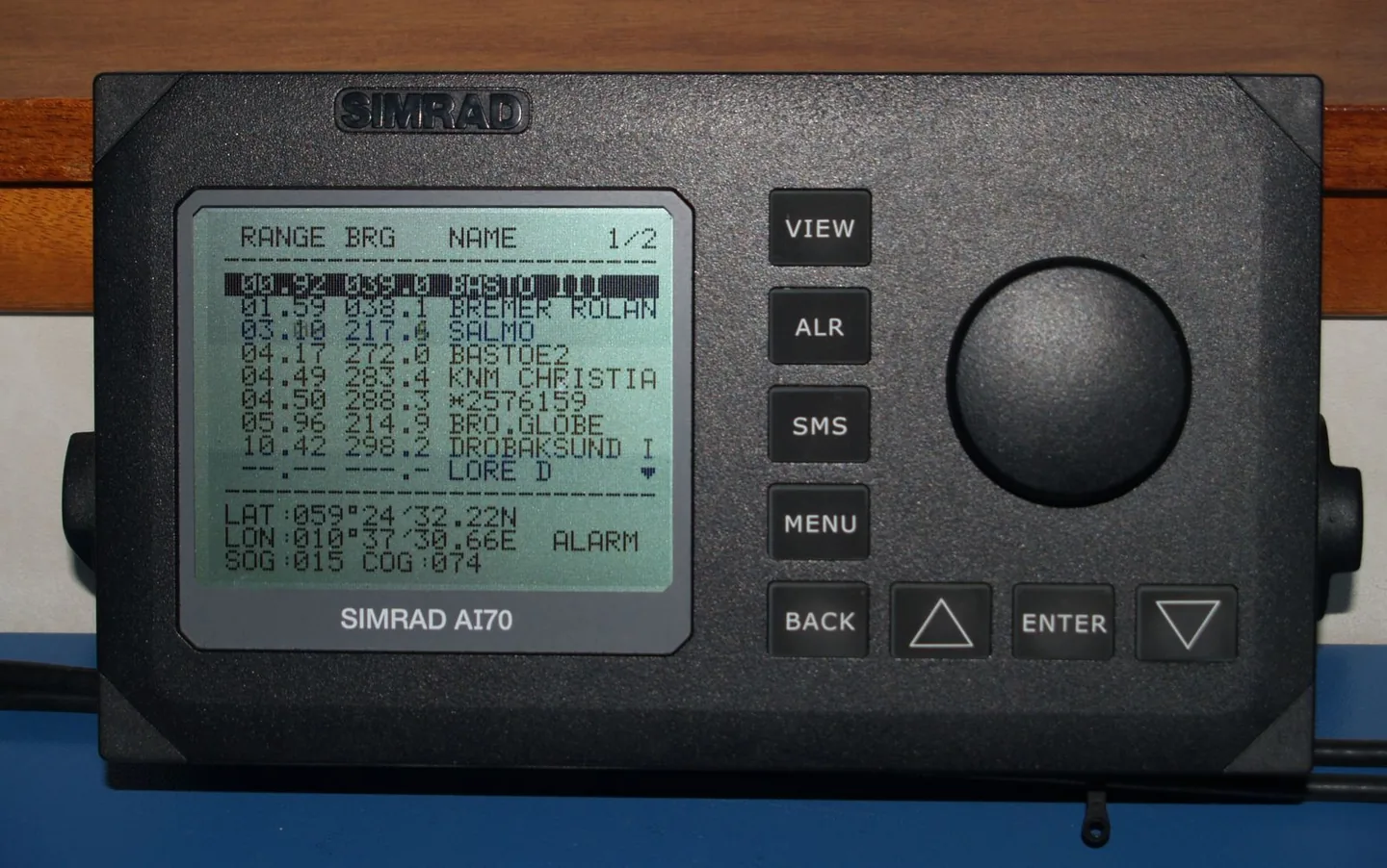
The operator must also learn the actual product’s symbology. IMO guidance distinguishes sleeping, activated, selected, dangerous and lost targets, with CPA/TCPA details and alarms depending on state. A short dockside exercise—selecting a target, reading its age and recognising loss—is more useful than assuming every brand presents these states identically.
Navigate with AIS, never inside an AIS bubble
AIS is incomplete by design and circumstance. Some leisure craft, fishing vessels, warships and shore stations are not fitted; other sets may be switched off, out of range or sending incorrect data. An electronic chart full of named targets can therefore create greater confidence than the underlying evidence warrants.
The IMO’s operational guidance is explicit about the hierarchy: AIS assists collision-avoidance decisions and supplements radar tracking, VTS and other information. It does not replace the lookout, relieve the watchkeeper of the COLREGs or justify action based on a single calculated CPA. Bearings, visual aspect, radar where fitted, sound signals and VHF context still matter.
“Silent” or transmit-off modes need a written onboard policy tied to the rules that apply. Mandatory vessels may switch off only in defined safety or security circumstances and may have reporting and log requirements; voluntary leisure users should not assume privacy preference overrides national conditions. Everyone at the helm should know whether receive remains active, how the inhibited state is shown and how normal transmission is restored.
A durable routine is simple. Before departure, check supply, GNSS, displayed MMSI and alarms. Underway, compare the screen with sight and radar rather than explaining away disagreements. After antenna, radio, chartplotter, battery or ownership work, repeat an external transmission check. AIS becomes dependable not because the screen is busy, but because its data is verified and its limits remain visible to the crew.
Sources and references
Sources consulted and references retained to verify data and context.
- Revised guidelines for the onboard operational use of shipborne AIS — Resolution A.1106(29)International Maritime Organization · 2015-12-02T00:00:00.000Z
- AIS Frequently Asked QuestionsU.S. Coast Guard Navigation Center
- Types of Automatic Identification SystemsU.S. Coast Guard Navigation Center
- AIS transpondersInternational Maritime Organization