Crossing a traffic separation scheme under Rule 10
An operational Rule 10 guide for small craft: right-angle heading, current, gap selection, AIS, VHF, VTS and the disciplined choice to postpone a crossing.
In brief
When a traffic lane must be crossed, COLREG Rule 10 calls for a heading as nearly as practicable at right angles to the general traffic flow. A small craft should plan the entire scheme, avoid impeding ships following the lane, maintain a proper lookout and safe speed, and continuously reassess collision risk, current and available sea room.
Article outline
Crossing a traffic separation scheme is not a dash across an empty strip on the chart. For a small craft, the safe crossing starts outside the lane, with an updated plan, a reliable lookout and enough time to make an intention obvious to ships that may need miles to alter their movement.
Rule 10 is only one part of the collision rules
COLREG Rule 10 governs conduct in and near traffic separation schemes adopted by the IMO. It does not displace the remaining rules, so lookout, safe speed, collision-risk assessment and timely avoiding action still apply from the approach until the vessel is clear.
When a vessel is obliged to cross a traffic lane, it should steer a heading as close as practicable to a right angle to the general traffic flow. The wording concerns heading rather than the line drawn by the vessel over the seabed. Tide or wind may therefore produce a diagonal ground track even while the bow presents the clear aspect expected by traffic in the lane.
A sailing vessel or a vessel under 20 metres must not impede the safe passage of a power-driven vessel following a lane. Small size is not a blanket right of way. It is a reason to create sea room early, before a constrained traffic picture forces either vessel into an urgent decision.
Build the plan around the whole scheme
The passage plan should show both lanes, their traffic directions, the separation line or zone, termination areas and any inshore traffic zone. An explanatory diagram on a government website is useful for orientation, but the UK Maritime and Coastguard Agency expressly warns that its Dover chart is not a navigational chart. Current official charts, notices and local publications remain essential.
Treat the crossing as one connected sequence: enter the first stream, clear it, deal with the central separation feature, then assess and cross the opposing stream. The shortest geometric line is not necessarily the safest window. Ferry patterns, visibility, current, sea state, crew workload and the craft's dependable performance can justify waiting outside the scheme.
Rule 10 normally keeps vessels out of separation zones except for stated exceptions, and calls for anchoring in or near a scheme's termination to be avoided as far as practicable. A central zone is therefore not a planned waiting room. If the gap disappears before entry, postponing from a safe position outside the scheme is usually more orderly than improvising halfway across.
Separate heading, course over ground and drift
Cross-current makes the right-angle instruction look counter-intuitive. Steering to make the ground track exactly square may require the bow to point obliquely into the stream, which can make the craft's aspect less readily understood. The legal phrase “as nearly as practicable” also recognises that the mariner must work with the conditions actually present.
Batoo analysis recommends writing down three separate values before committing: lane direction, intended heading and estimated set or leeway. Modern displays can add COG, SOG, CPA and TCPA, but a single calculated number is not a verdict. Radar, AIS, compass information, visual bearings and hearing should agree sufficiently to support the decision, and the crew should remember that not every target transmits AIS or carries accurate transmitted data.
Consistency helps other bridges interpret the manoeuvre. A chain of small course changes makes predicted closest approach fluctuate and obscures intent. When circumstances allow, an early and substantial alteration is generally easier to read than repeated fine corrections.
Select a gap across several targets
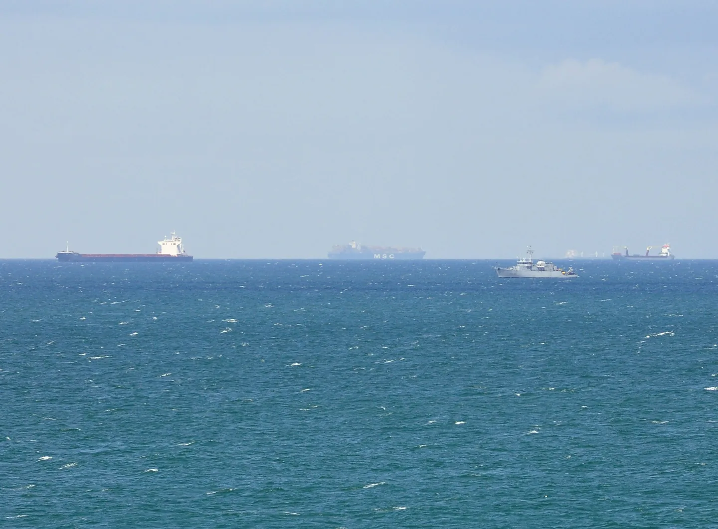
A usable gap exists in relation to the traffic sequence, not merely the closest ship. Passing behind one vessel can reveal another on the same track, and high-speed cross-channel ferries can consume an apparently comfortable interval quickly. Scan well beyond the first contact before committing.
The lookout should compare bearing, range and their trend over time. A steady or nearly steady bearing with decreasing range is a warning that deserves continued checking even when the electronic CPA looks generous. Batoo does not assign one universal passing distance: an appropriate onboard margin depends on visibility, manoeuvrability, sea room, sea state and sensor confidence.
If collision risk develops, Rule 10 does not erase the other steering and sailing obligations. “Not to impede” calls for early action that leaves sufficient room, but it is not permission for the lane-following vessel or the crossing craft to continue into obvious danger. Apply the full rules to the situation as it evolves rather than clinging to the label chosen at the start.
Use VHF, AIS and VTS for their proper jobs
VHF can supply traffic information or resolve a clearly identified uncertainty, but an imprecise radio exchange is not a collision-avoidance plan. Any call should identify the vessels and proposed action unambiguously. Silence is not agreement, and a radio arrangement cannot override safe conduct under the COLREG.
In the Dover Strait, Channel VTS provides a continuous radio and radar service operated jointly by the United Kingdom and France. The official guidance says more than 400 commercial vessels use the strait daily. VTS supplies information and observes traffic; it does not take the navigational decision away from the person in command.
CALDOVREP mandatory reporting applies to vessels over 300 gross tonnes in its service area. That threshold should not be casually applied to every leisure craft. Local requirements still need checking before departure, along with the correct working channels and the current limits of the reporting area.
Inshore zones and a disciplined abort decision
An inshore traffic zone is not automatically a quiet refuge. Rule 10 permits its use by vessels under 20 metres, sailing vessels and fishing vessels in specified circumstances, while other routes to or from places within the zone and immediate danger are also addressed. Local charting and guidance determine where the zone actually lies.
The MCA's MGN 364 (M+F) Amendment 2 was published on 3 December 2024 and expressly includes pleasure-vessel users among its audience. Because routing measures and operating procedures can change, a skipper should check the current edition of charts, notices, radio information and coastal-state guidance rather than relying on a remembered diagram.
An abort decision belongs before the craft runs out of options. Machinery trouble, deteriorating visibility, fatigue, misunderstood targets or a growing difference between predicted and observed movement all demand a fresh assessment. Once inside a lane, stopping or turning back may create a worse geometry, so the response must be based on the live traffic picture and made conspicuous.
The transferable method is to prepare, observe, choose, communicate intent through movement and verify until fully clear. It cannot guarantee a crossing. It does, however, keep Rule 10 connected to the real vessel, the surrounding traffic and the limits of the people operating it.
Sources and references
Sources consulted and references retained to verify data and context.
- COLREG - Preventing collisions at seaInternational Maritime Organization
- Navigation Rules and Regulations HandbookU.S. Coast Guard Navigation Center
- MGN 364 (M+F) Amendment 2: Traffic separation schemes and Dover Strait navigationUK Maritime and Coastguard Agency · 2024-12-03
- Dover Strait crossings: Channel Navigation Information ServiceUK Maritime and Coastguard Agency
- Revised guidelines for the onboard operational use of shipborne AISInternational Maritime Organization via U.S. Coast Guard Navigation Center · 2015-12-02
Continue reading
406 MHz EPIRB and PLB: choosing, registering and testing
September 27, 2026 · 7 min read

Navigation lights: inspect and test them aboard
September 26, 2026 · 7 min read
Boat reboarding ladders: test them from the water
September 25, 2026 · 7 min read